Badwater 135 Recon
Just in case it hasn’t already been real enough, sh*t got really real last weekend when Billy, Colin and I spent a few days in Lone Pine checking out the Badwater 135 course.
I’ve crewed and paced the race three times so I know the original course fairly well, but due to silly politics at Death Valley National Park resulting in a ban on sporting events in the Park, Adventure Corps was forced to change the course for this year’s race. (Click on below for a larger image.)
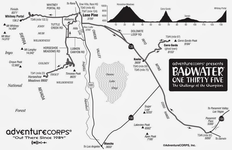
The last 43 miles, from Darwin (lower right corner of the map) to the finish at the Mt. Whitney Portal (upper left corner of the map) are the same as before, but the first 92 imiles are brand new. Of those 92 miles, there were two sections that I really wanted to check out during the recon trip:
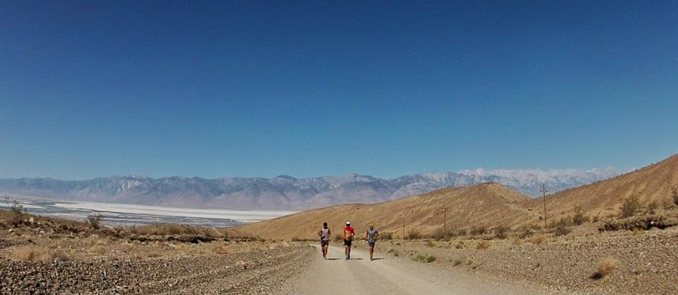
- The road going from Lone Pine to Horseshoe Meadows. This out-and-back is the first 46 miles of the race; 23 miles up and then 23 miles back down. You start at 3,700 feet at climb up to nearly 9,990 feet. You get about 6,400 feet of gain (and 300 feet of loss) on the way up and then about 6,400 feet of loss and 300 feet of gain on the way back down.
- The dirt road from Keeler up to the Cerro Gordo ghost town. This 16 mile out-and-back starts at mile 59 of the race. It’s another big climb. You start at 3,700 feet and go up to about 7,900 feet. It’s 4,500 feet of gain (and a couple hundred feet of loss) on the way up and then the reverse on the way back down. It’s a hard-packed dirt road.
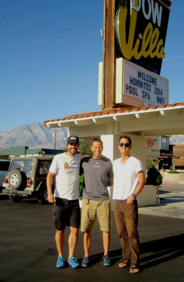
We drove out to Lone Pine Friday evening and arrived in time to go out for a sunset run/rock scramble in the Alabama Hills just outside of town.
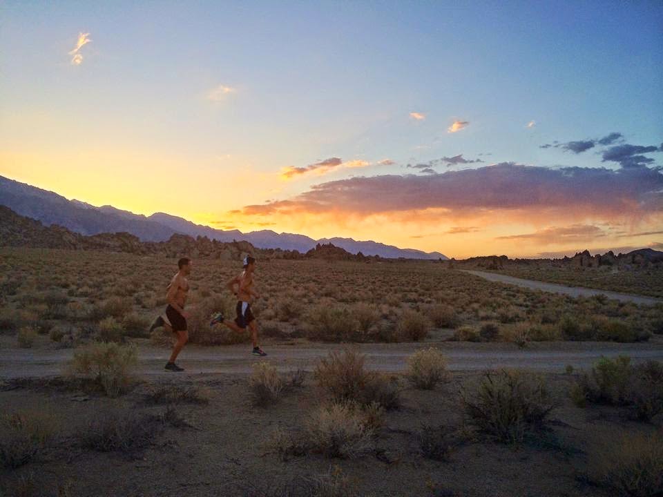
We were all stiff and tired from the drive and instead of doing a real “run” we sort of just explored the scenery and stretched out our legs. Dinner was at the Pizza Factory.
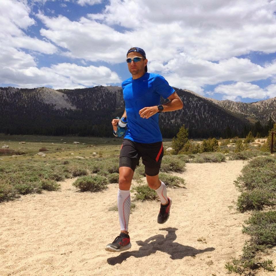
The plan for Saturday was to run about 20 miles exploring the Horseshoe Meadows Road. Because we weren’t in a rush, we slept in a little bit. We picked a spot about 14 miles into the climb where we would park and then drove another 6.5 miles up from there to drop water, figuring we could refill there on the way up and back down; we weren’t sure if there would be water up at the Horseshoe Meadows campground (it turns out there is) and figured this way we would have water at miles 6.5 and 13.5 of the run.
During the drive up my heart was definitely racing. Seeing that road for the first time was more than a little frightening. It climbs quickly out of Lone Pine and winds up and up. From the switchbacks, you get these crazy views of where you came from far down below and where your’re headed way up above. And the road feels really steep. It was getting warm when we left Lone Pine at around 9:30 but the temperature steadily dropped while we climbed. There was probably a 20 degree temperature difference between Lone Pine and where we parked the car at 7,700 feet.
Once we started running, my fears subsided. It’s a tough climb, but I do believe that as long as I run smart, it will be manageable.
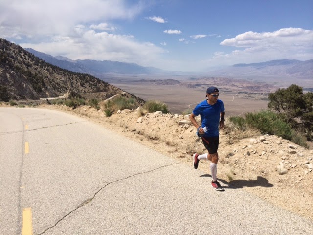
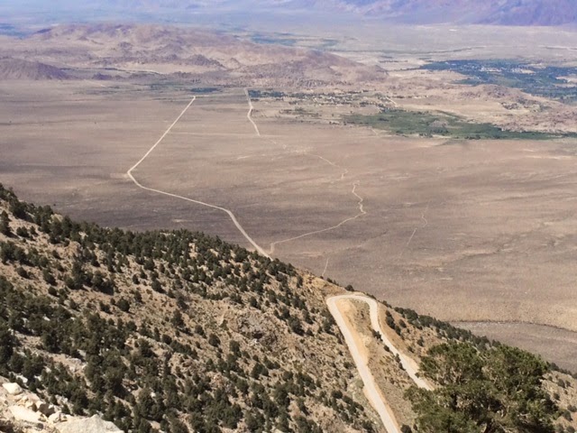
I’ll mix in hiking and make sure to stay well-fueled and hydrated. Granted, I only ran about a third of it, but I felt good on the climb. The views of Owens Valley far below are pretty amazing. In the below photo, you can see Lone Pine far off in the distance and the thick white line in the valley below is near the beginning of the course (about 15 miles away).
We got to the turn-around point at the Horseshoe Meadows campground and decided to explore a little bit of the trails up there. We went out about two miles on the Cottonwood Lakes Trail. About a mile outside the campground, you start getting glimpses of the massive meadow framed by the Sierra. It’s stunning.
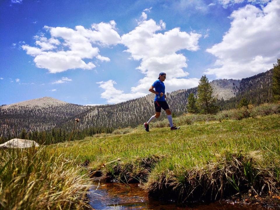
That’s not part of the race course, but definitely worth a visit for a hike or trail run.
As much as I got my fears a bit under control during the climb, they shot back through the roof during the descent. Those 23 miles on pavement are going to be really tough. The road is smooth and except for a short climb two miles from the top, it’s all down, down, down.
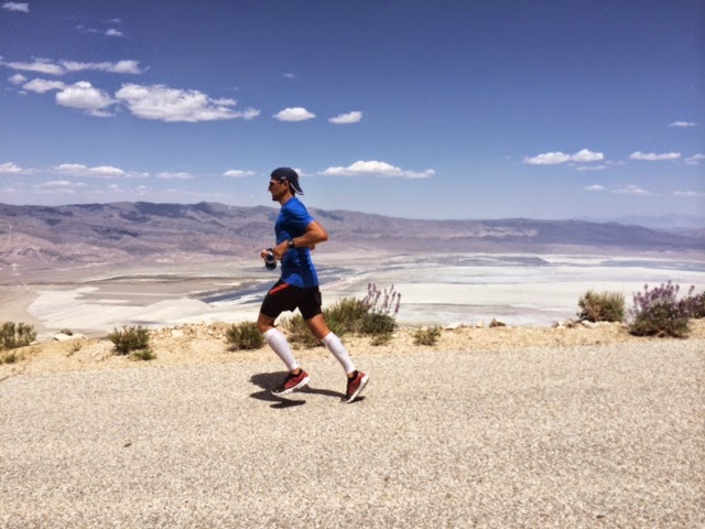
It would be an easy road to run fast down for a bit. But that would be a great way to destroy the legs. The first real key to my race will be managing that descent. I want to move steadily down but I also need to be very careful about saving my legs for the next 90 miles. Billy had turned back a little early on the climb, so he crewed Colin and I for most of our descent. That was huge because we got to stop and refuel every couple miles instead of just pounding, pounding, pounding all the way down. The top of this climb would be a great place to swap out shoes for something more cushioned and forgiving, like the Skechers GOrun Ultra. (Click for the Strava details of the run.)
When we finished, we had a big meal at Bonanza Mexican Restaurant, then chilled at the hotel and went for a swim before it was time to walk around town a little bit and then have dinner at Totem. At one point, we had planned on doing a trail run on Saturday evening, but after the late finish of the first run plus being wiped out from the long day, we decided to skip it.
Sunday morning, we got up earlier and met Badwater Ben Jones for breakfast. When I had reached out to him and told him our plan to run up and down Cerro Gordo, he immediately volunteered to crew us during the run. We had planned on doing it unsupported, but Ben was a real life-saver! We had a great time with him.

Ben has so much history in the area and with the Badwater race. We could have talked to him all day. He was an awesome crew, stopping regularly on the way up and taking tons of photos.
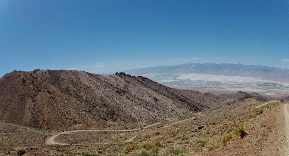
The climb up the Cerro Gordo road is only 7.8 miles, but it’s going to feel much tougher than the Horseshoe Meadows climb. And not only because we’ll already have done the Horseshoe Meadows climb and descent plus another 14 miles from Lone Pine to Keeler before we start the Cerro Gordo climb. It starts out at a decent-but-not-crazy 6% grade, climbing 313 feet in the first mile. But each mile gets steeper and steeper: 8%, then 8.5%, then 11% and the last 2.9 miles are really nasty; during those 2.9 miles you gain over 2,100 feet for an average grade of 14%. I was moving slowly on relatively fresh legs. I don’t even want to think about what that’s going to be like during the race. (Click for the Strava details of the run.)
During the first few miles of this climb, the road goes in between two pretty tall rock walls so there really aren’t any views.
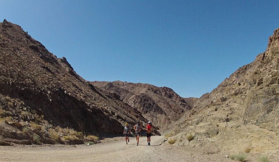
But during the last few miles, you get great views of the Owens Valley from the opposite side of Owens Lake. You can see the Horseshoe Meadows switchbacks and the Whitney Portal road.
When we started at the bottom at around 8:40, it was already pretty hot and the first three miles of the climb were boiling. There is no shade at all. One nice thing is that by the time I get to this climb during the race it should be at least early evening and hopefully starting to cool down a bit.
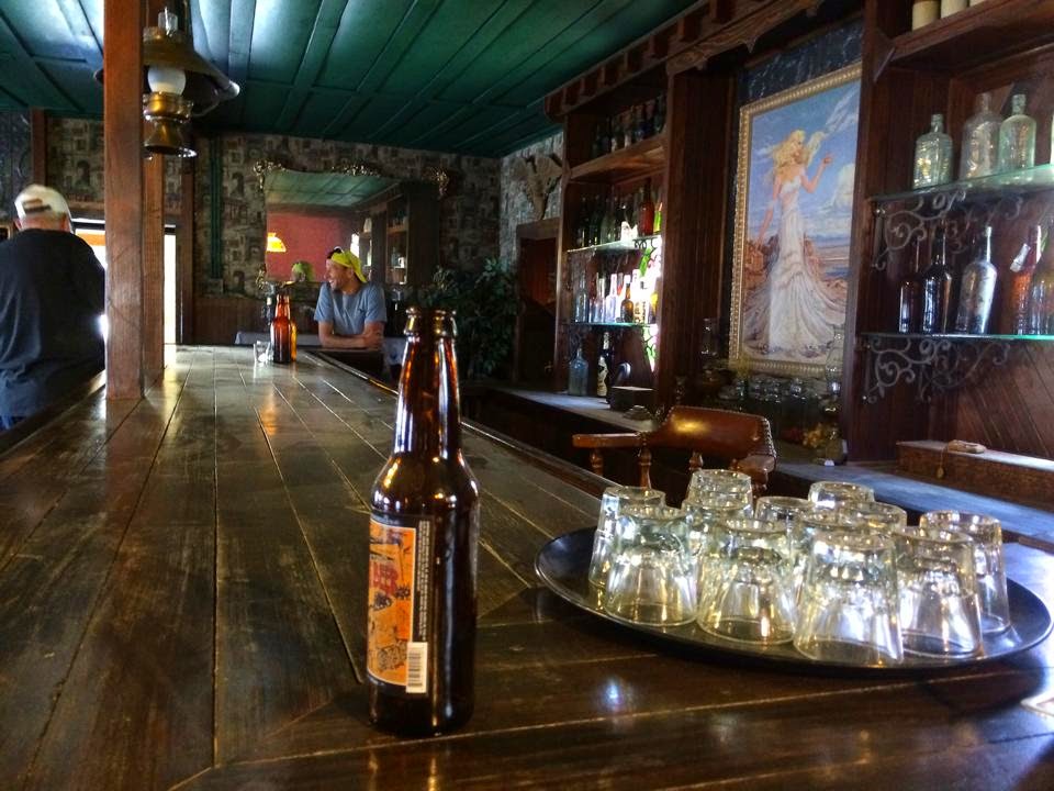
At the top of the climb, you get to the Cerro Gordo ghost town. It’s really rad. Ben had talked to the volunteer caretakers who live up there and we took a break from the run to get a tour.
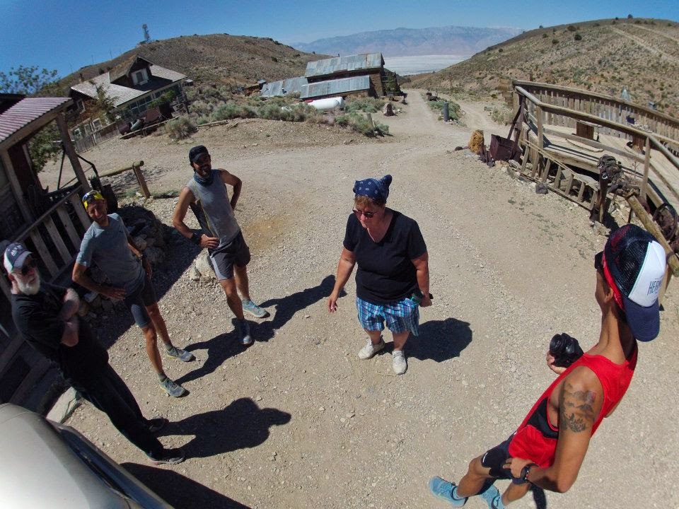
Most of the structures up there are from the late 19th and early 20th century when they were mining silver and zinc. The original hotel up there – The American Hotel – still stands. The interior was renovated in the 1980s and turned into a bed and breakfast (but not a frequently used one I think). A lot of the original details were kept intact, like a huge stove and a card room where there are still bullet holes in the walls. In the 1980s, the owners put in a long wooden bar. Ben said that the hotel might be the checkpoint at this part of the race.
The ghost town is a really neat part of California history and I’m glad that we had the opportunity to see it. I would definitely recommend taking a side trip up there to check it out.
The run down was easy, especially after the break for the tour.
It will not be like that on race day, but the dirt road descent is much more forgiving than the pavement descent from Horseshoe Meadows.
A few words of warning about these 16 miles to and from the Cerro Gordo ghost town: As I mentioned above, this section of the race is going to be very tough. It took us just over two hours to do the climb on relatively fresh legs. We didn’t push the pace and stopped a bunch of times for Ben to crew us, but I would be surprised if it takes me less than 2.5 hours to climb those 8 miles during the race (and it could take a lot longer). Assuming Adventure Corps sticks to the current plan of no crew vehicles (which makes sense given the sketchy narrow road) and no aid except water at the top, runners and their pacer are going to have to carry a lot of supplies – enough nutrition for at least 4-5 hours round-trip, enough water for the 2.5+ hour climb, in addition to a headlamp and maybe some warmer clothes in case it’s cooler at 8,000 feet that night. It would be really nice to have a water-only station at this barbeque pit/turn-off area about five miles up the climb…
After the run, we had lunch with Ben at the Alabama Hills Cafe and then hit the road for home.
Huge thanks to Billy and Colin for coming out there for the weekend, helping out with all the logistics, running with me and for taking so many pictures.
I’m already looking forward to going back with those guys for the race in less than six weeks. Also, thanks again to Badwater Ben for the help and all the information on Sunday.
The conditions were about what I expected. Hot down around Lone Pine, much cooler as we climbed. It’s going to be even hotter in six weeks, but hopefully it will still cool down when we climb. The hottest parts of the course will probably be the trip from Lone Pine to Keeler on Monday evening and the return from Darwin to Lone Pine on Tuesday morning (I hope).
Tailwind was great during both runs and will be awesome during the race. It’s easy to drink and the calories plus electrolytes kept me going strong throughout both runs. If you’ve made it this far and haven’t seen the kick-ass video that Billy Yang made for Tailwind, check it out here:
That’s cool Josh, thanks for sharing this,
Sam
Just awesome! See there next month!
Phil
looks like everything is going smoothly! looking forward to your race journey!