13 Days To Go
We’re spending the Memorial Day weekend out in Palm Springs with some friends. When we came out here in April 2010, I was training for AC and I spent a day running the trails in Joshua Tree National Park. Running in Joshua Tree was great and there are plenty of trails that I didn’t have time to explore, but this trip, since I’m tapering and don’t need very many miles, I didn’t want to drive that far to run.
For years, I’ve been talking about doing the Cactus to Clouds run (Palm Springs at about 520 feet to the summit of Mt. San Jacinto at 10,834 feet), but I knew that a 20+ mile run with over 10,000 feet of elevation gain would be a bad idea this close to San Diego 100. But there’s another option to get to the summit – you can take the Palm Springs Tram up a good chunk of the way (to the “Mountain Station” at 8,516 feet) and hike/run to the peak of Mt. San Jacinto from there. First you drive to the lower tram station at 2,643 feet and then ride the tram up to 8,516 feet. The ride takes about 10 minutes. From the Mountain Station, it’s about 5.5 miles with a little over 2,200 feet of elevation gain to the summit at 10,834 feet. I figured I’d do the round-trip and maybe add a few miles somewhere along the route.
The first tram to up is at 8am. When I got to the station at 7:50, the 8am was sold out, but I had no problem buying a ticket for the 8:15. (Tickets are $23.95 round-trip. Not cheap, but well worth it for the experience.) While I was waiting, I started talking to a guy wearing an AC100 t-shirt. Doug is not a runner, but has volunteered at the race a bunch of times. It was interesting to hear some stories about his experiences at different aid stations. He’ll be at Mt. Hillyer this year, so, those of you running should look out for him. I’m sure he’ll be ready to hook you up with whatever you need!
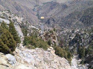
This is the view from the tram looking down. We’re almost at the top. If you click on the photo you can sorta see where it starts all the way at the bottom:
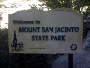
From the tram station you run down a paved path, past the State Park sign
and a tiny bit on the start of the trail before you get to the ranger station. You have to get a permit (which just means filling out a form with your information and hiking/camping plans).
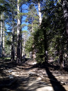
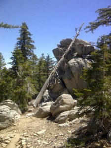
From there, the trail is pretty obvious. In general, the trail is pretty well worn and the intersections are marked with signs noting the distances between points. You just follow all the signs to San Jacinto. At 8am, it was already in the 80s in Palm Springs, but since I was starting this run at 8,500 feet, it was considerably cooler (probably was low 60s yesterday morning). The trail is pretty with lots of pine trees.
The trail is a little technical, with frequent turns and rocks and roots strewn across it, but pretty runnable for the most part. Also, since it only climbs 2,200 feet over the 5.5 miles to the top, it’s never super steep for prolonged periods of time. I wasn’t in any hurry yesterday, so I took it really easy, stopped to take a bunch of photos and check out the views.
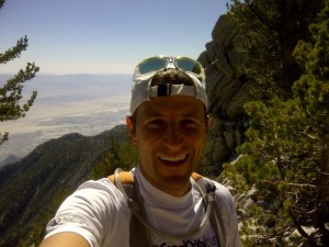
I missed one turn about 4.3 miles into the run and ended up at the overlook with a pretty fantastic view of the Coachella Valley.
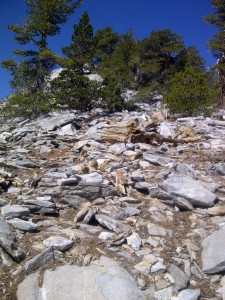
As I was headed back towards where I thought the trail was, I ran into a hiker who told me that I could either backtrack a little bit to the trail or just head up a scrambling way to the summit. I looked up and decided, I’d rather do the scramble.
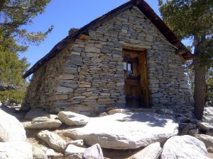
A few more hundreds yards up the mountain, I reached the emergency hut.
I peeked inside. There are a few bunks and some emergency supplies, but it was a little creepy and I didn’t want to go in. From the hut, it’s about 1/3 mile to the summit.
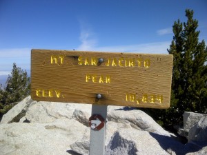
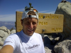
It was cool at the summit – mid-50s? – but it felt great and the views were fantastic. You can see Baldy, San Gorgonio, the Coachella Valley, far towards LA and supposedly Las Vegas. I sat a the summit and talked with that hiker I met for 10 minutes or so before heading back down.
On the way down, I followed the “real” trail instead of the scramble I took up. The trail was considerably more crowded than it had been during the ascent. There weren’t that many people and everyone was really nice, but since it’s all single track, there was some maneuvering to do. I didn’t see any other runners out there yesterday. (From the crowds at the bottom when I finished, I’m guessing it gets pretty packed a little later in the day.)
Since I wanted a few extra miles, I explored a little bit, taking a slightly longer route around Round Valley and doing an out-and-back into the Hidden Divide Nature Preserve. There are a fair number of off-shoot trails, including one that heads down into Idyllwild. It would be a fun place to do some long runs, but I don’t know if there’s any drinking water other than at the Tram Station.
Running from the tram stop at the Mountain Station to the summit is a relatively easy way to get above 10,000 feet. Going at a casual pace, the run to the top took me about 1:20, I bet you could hike it in around two hours.
This morning, I decided to check out another section of the Cactus to Clouds run/hike. The trail officially starts right in the middle of Palm Springs, in the back corner of the parking lot of the Palm Springs Art Museum. I figured I’d go four miles out and four back.
I knew it was a healthy climb, but when I got to the trailhead and looked up, I was pretty surprised. A sign warned about the strenuousness of the trail and indicated that it climbed about 1,000 feet in the first mile. Looking up, that seemed about right. This trail is steep and rocky and technical and twisty-turny. Also, since it starts at around 550 feet, it was hot when I started. I realized pretty quickly that going four miles out in the heat while I’m tapering would be a dumb idea. In the end, I went out about 2.5 miles (2,200-ish feet of gain) and turned back, finishing my run with a couple miles in downtown Palm Springs. The trail is sorta easy to follow, but, other than some white dots irregularly painted on rocks, it’s not marked. There are small offshoots all over the place – I think where people have cut the switchbacks. In general, everything seemed to come back to the same place. If the first 10 miles of the Cactus to Clouds is like the 2.5 miles that I ran today, that’s a hell of a run. (And it probably is, since you have to get from 550 feet to 8,500 over those 10 miles.)
Now that I sort of know what I’m doing, I’ll hopefully come back at some point this summer or fall to tackle the whole thing!
And now, it’s really really time to taper!
Nice write up dude. Def count me in if you decide to do the whole route!